← All selected work

Numerical modelling · Variable-resolution NWP

Variable-resolution forecasting of Typhoon Higos

Evaluated a targeted MPAS-A mesh against global guidance for the track and rapid intensification of Typhoon Higos.

ClusterTech · CPAS technical case study2020
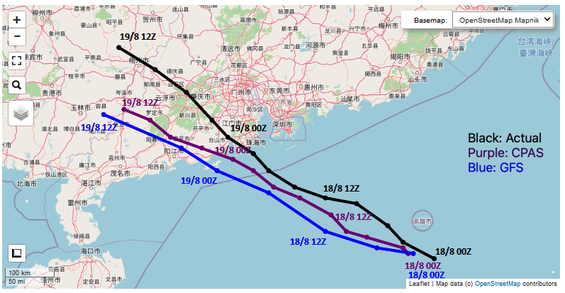
Observed, CPAS and GFS tracks for Typhoon Higos
Observed HKO track compared with CPAS and GFS guidance initialized at 00Z on 18 August 2020. Source: CPAS/ClusterTech.
+24 hforecast horizon
128–8–4km mesh
159kmesh cells
985 hPaforecast minimum

01 / Question

Why this problem mattered

Typhoon Higos was small, rapidly intensifying and initially forecast by major global models to remain weaker and track farther west. This case examined whether concentrating resolution over the western North Pacific and the Pearl River Delta could recover more useful short-range track and intensity detail.

02 / Approach

From physical fields to usable evidence

  1. Initialized the CPAS global model from GFS conditions at 00Z on 18 August 2020 and ran MPAS-A physics on a variable-resolution mesh.
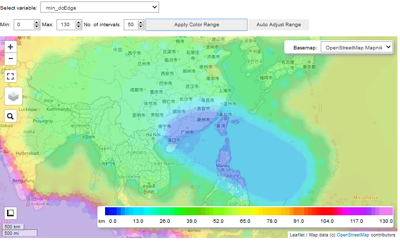
  2. Allocated approximately 8 km resolution across the tropical-cyclone target region and 4 km resolution for coastal and orographic refinement within a 128 km global mesh.
  3. Compared the +24-hour CPAS track, minimum sea-level pressure and 10 m wind prediction with GFS guidance and the observed HKO track.

03 / Result

The targeted mesh produced a more useful single-case forecast of Higos.

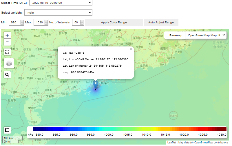
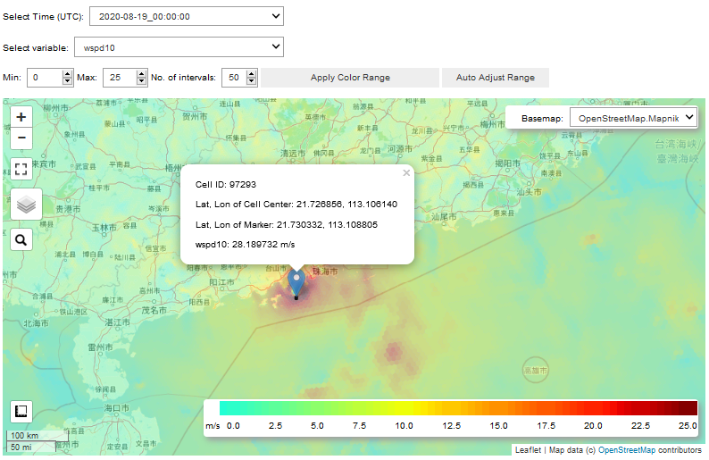
At +24 hours, CPAS forecast a minimum pressure near 985 hPa and maximum sustained wind near 28 m/s, compared with roughly 998 hPa and 20 m/s in the cited GFS forecast. The predicted landfall was only a few tens of kilometres west of the observed track.

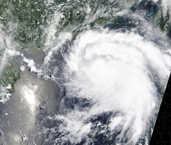
Satellite view of Typhoon Higos over the northern South China Sea
Satellite view of Typhoon Higos approaching the South China coast in August 2020.
Variable-resolution CPAS mesh over Asia and the western North Pacific
CPAS mesh-density view, concentrating resolution over the western North Pacific and coastal target region. Source: CPAS/ClusterTech.
CPAS forecast minimum sea-level pressure for Typhoon Higos
Forecast minimum sea-level pressure at 00Z on 19 August, with a value near 985 hPa at the storm centre. Source: CPAS/ClusterTech.
CPAS forecast 10 metre wind speed for Typhoon Higos
Forecast 10 m wind-speed field for Higos at the same valid time. Source: CPAS/ClusterTech.

04

Implications

The case suggests that variable resolution can place computational effort where small-scale tropical-cyclone structure and coastal detail matter most. It also illustrates an end-to-end modelling workflow: mesh design, numerical integration, forecast-field extraction, visualisation and communication of operationally relevant differences.

05

Limitations

This is a single, self-reported case study—not a controlled multi-storm benchmark or proof of general superiority over GFS. Differences may reflect resolution, physics choices, initialization and case-specific predictability. The defensible conclusion is that the configuration showed promise and warranted broader verification.