← All selected work

Remote sensing ML · Deep learning

Reconstructing radar-observed storm structure from satellite imagery

Trained a convolutional encoder–decoder to reconstruct storm-scale radar fields from visible and infrared satellite imagery.

Completed course project · Imperial College London2025
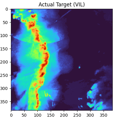
Observed vertically integrated liquid radar field
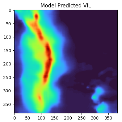
U-Net reconstructed vertically integrated liquid radar field
Observed radar VIL (left) and the U-Net reconstruction (right) for the same held-out storm frame. The model retains the main convective corridor while smoothing some fine-scale structure.
800storm events
12,000image frames
384²output grid
50training epochs

01 / Question

Why this problem mattered

Weather radar offers detailed precipitation structure but its coverage can be constrained by range, terrain and data availability. Geostationary satellite imagery is broader and more continuous. This completed project tested whether a deep convolutional model could learn the spatial relationship between multispectral satellite observations and radar-derived vertically integrated liquid.

02 / Approach

From physical fields to usable evidence

  1. Prepared 800 SEVIR storm events with visible, 6.9 μm and 10.7 μm infrared channels paired with radar VIL, sampling 15 frames from each event.
  2. Upsampled the infrared channels to a common 384 × 384 grid and stacked all three satellite channels as inputs to a six-stage U-Net with encoder–decoder skip connections.
  3. Trained the model for 50 epochs with L1 loss and Adam on a GPU, then compared held-out reconstructions with the observed radar targets and the training history.

03 / Result

The reconstruction recovered the main storm corridor and its strongest embedded cores.

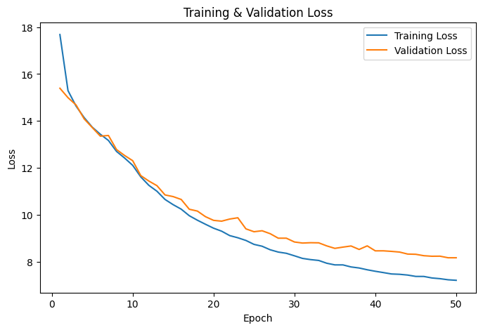
After 50 epochs, training L1 loss fell from 17.68 to 7.21 and validation loss from 15.39 to 8.17. In the visual comparison, the prediction reproduced the location, orientation and broad intensity gradient of the observed convective line, although the output was smoother and omitted some smaller-scale detail.
Animated sequence of visible and infrared satellite channels alongside the corresponding radar VIL target
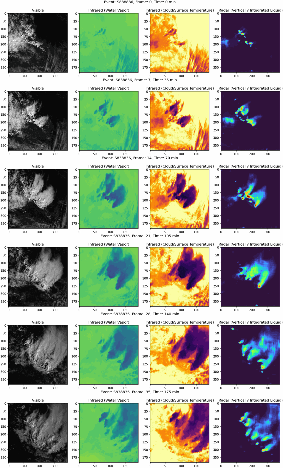
A held-out storm sequence evolving through time: visible imagery, water-vapour and cloud-top-temperature infrared channels, and the corresponding radar VIL target.
Training and validation L1 loss over fifty epochs
Training and validation L1 loss across 50 epochs. Both curves decline consistently, with a gradually widening generalisation gap.

04

Implications

The result shows that visible and infrared satellite structure contains enough information for a U-Net to recover meaningful radar-like spatial organization. It is a technically strong bridge between meteorological remote sensing and image-to-image machine learning, with potential relevance to radar-gap filling and satellite-based precipitation analysis.

05

Limitations

The notebook performs its 80/20 split after flattening the 15 frames from each storm, so temporally related frames from the same event may occur in both subsets. The reported validation loss may therefore be optimistic. A production-quality follow-up should split by storm event and add spatial and threshold-based verification such as SSIM, CSI and high-VIL recall.