← All selected work

Radar nowcasting · Operational meteorology

One-minute phased-array radar for high-impact weather nowcasting

Analysed one-minute dual-polarisation radar observations of hail, a waterspout and an airport-area squall thunderstorm.

Hong Kong Observatory · Guangdong–Hong Kong–Macao Seminar2023
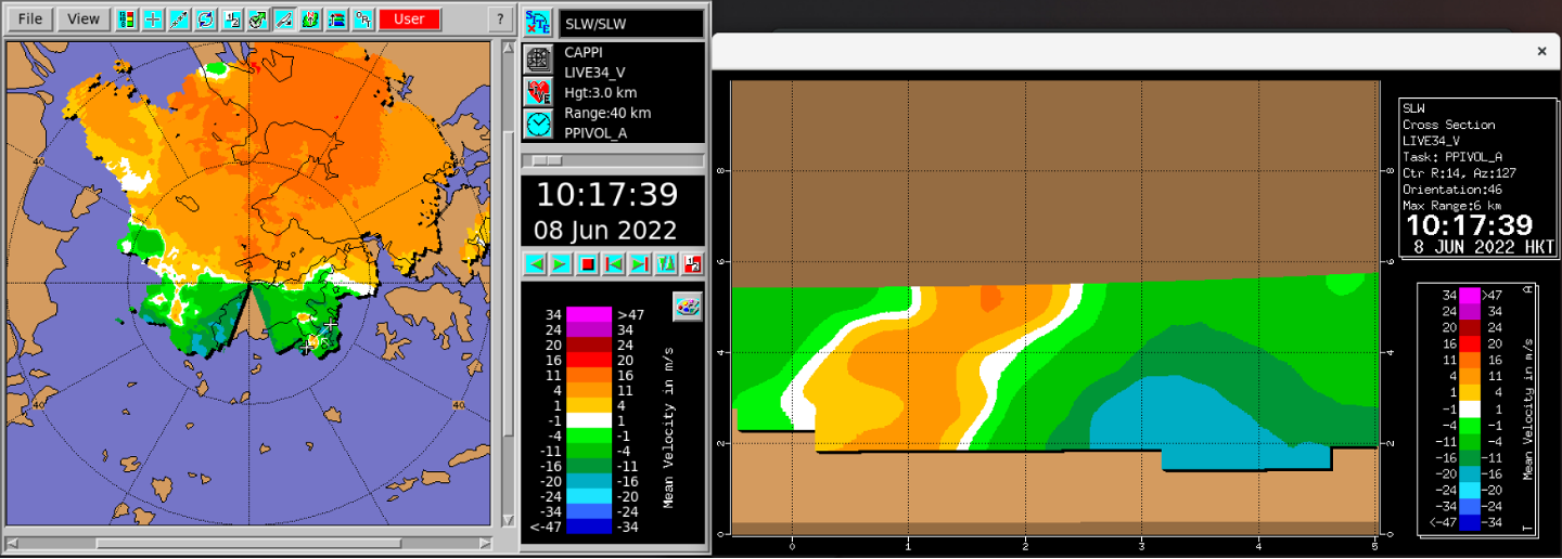
Plan view and vertical cross-section of Doppler velocity from the Sha Lo Wan phased-array radar
Plan view and vertical Doppler-velocity cross-section from the Sha Lo Wan phased-array radar during the Cheung Chau waterspout case at 10:17 HKT on 8 June 2022.
1 minvolume scan
68elevation layers
30 mhorizontal resolution
3event studies

01 / Question

Why this problem mattered

Conventional radar volume scans can miss important stages of rapidly evolving convection. The Sha Lo Wan X-band dual-polarisation phased-array radar offered much faster updates and denser vertical sampling, creating an opportunity to examine how those observations could support operational diagnosis and nowcasting.

02 / Approach

From physical fields to usable evidence

  1. Analysed hail over eastern Hong Kong, a waterspout near Cheung Chau and a severe squall thunderstorm near Chek Lap Kok during 2021–2022.
  2. Combined reflectivity, Doppler velocity, hydrometeor classification and differential-reflectivity products to diagnose three-dimensional storm structure.
  3. Compared selected signatures with observations from Hong Kong's C-band and S-band radars to understand the advantages and constraints of the X-band system.

03 / Result

Rapid updates captured storm-scale structures with direct nowcasting value.

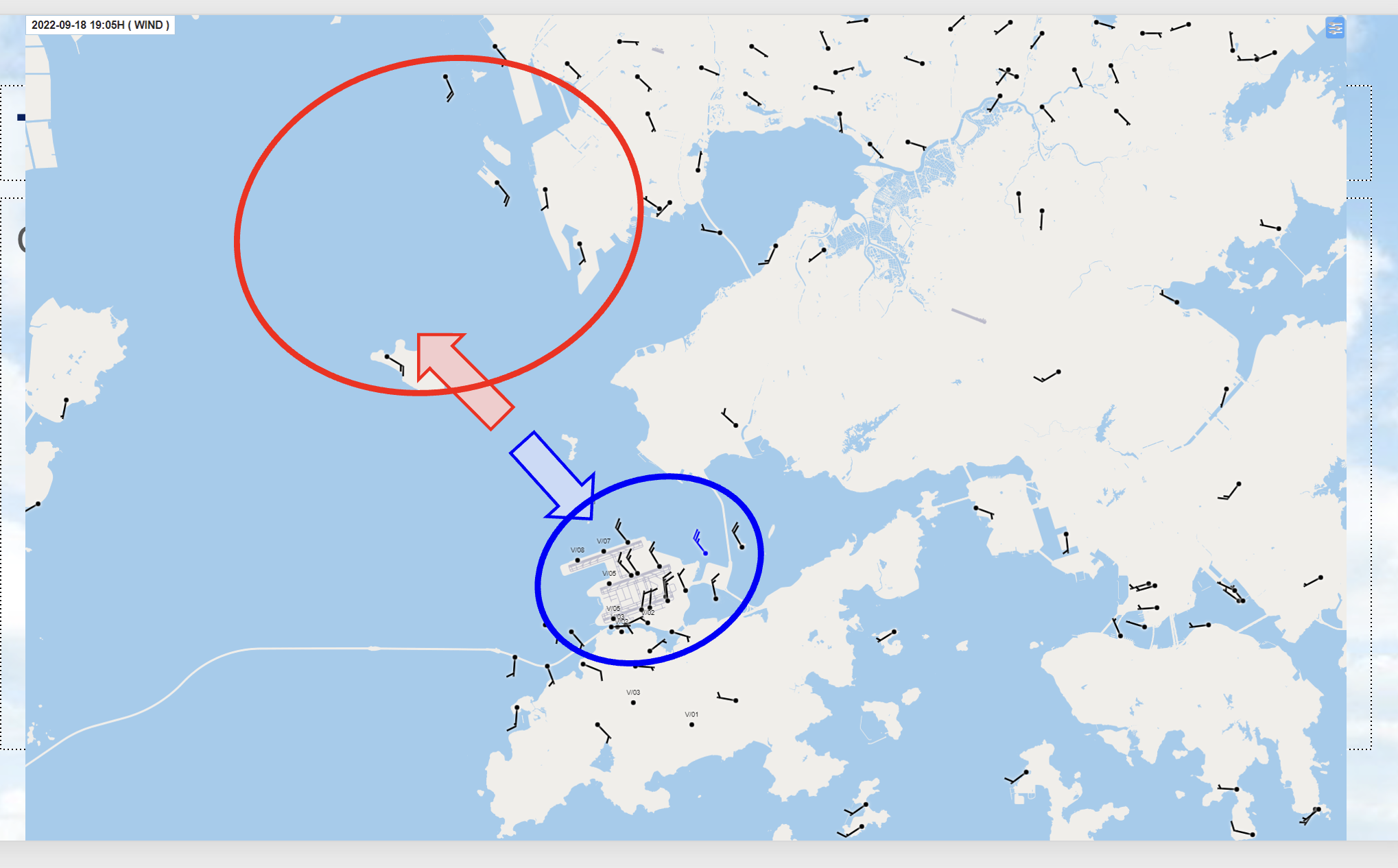
The radar resolved hail signatures aloft, a waterspout-associated velocity couplet extending through several kilometres, and the evolving outflow and dual-polarisation structure of a severe airport-area thunderstorm. At Chek Lap Kok, the 19:04 HKT Doppler-velocity cross-section and surface winds observed one minute later documented the same rapidly changing low-level outflow environment. The one-minute volume updates made this evolution much easier to follow.

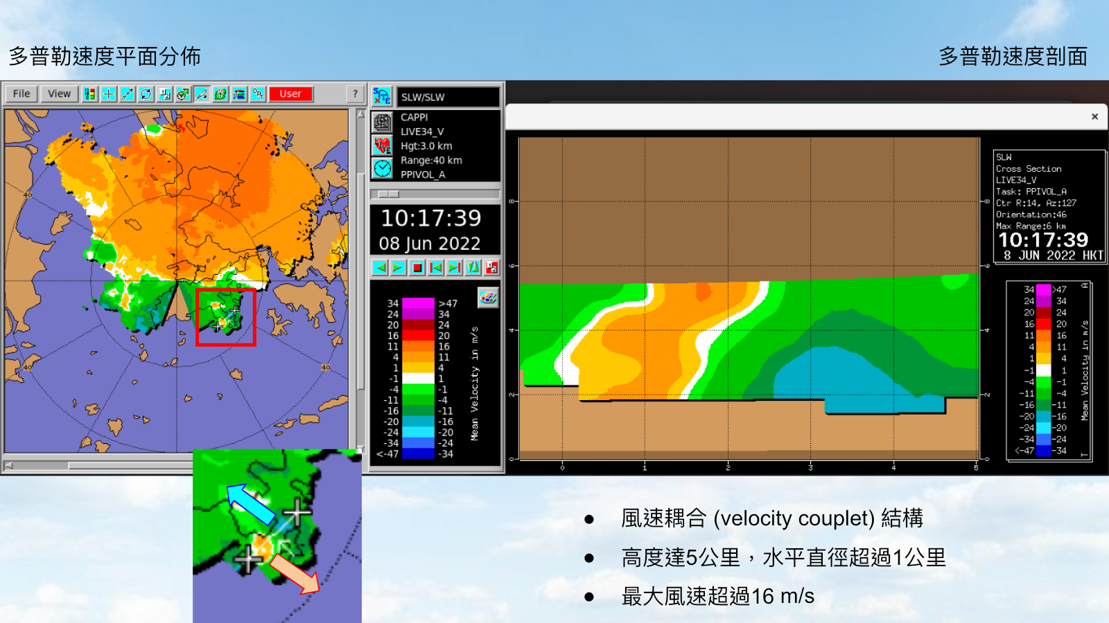
Original seminar slide showing a red box around the Cheung Chau waterspout velocity couplet and its vertical cross-section
Cheung Chau waterspout at 10:17 HKT on 8 June 2022. The red box locates the velocity couplet in plan view; the cross-section shows opposite-signed Doppler velocities extending to about 5 km, over a horizontal scale greater than 1 km, with maximum wind speeds above 16 m/s.
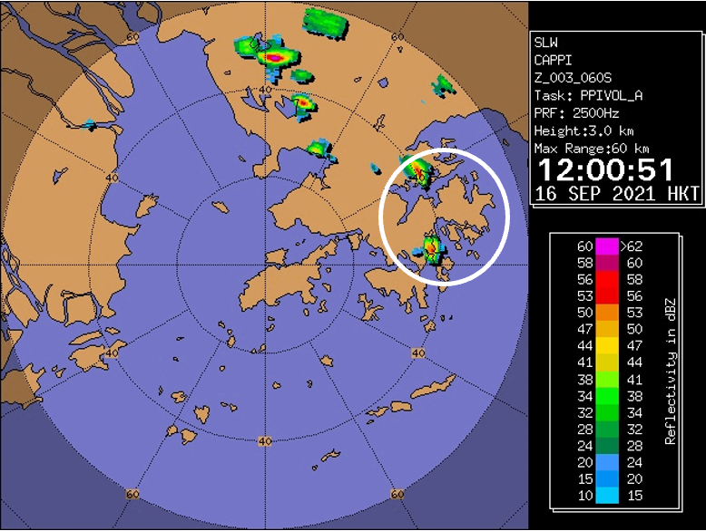
Three-kilometre CAPPI reflectivity with hail-producing cells circled over eastern Hong Kong
Hail case at 12:00:51 HKT on 16 September 2021. The white circle isolates the compact convective cells examined over eastern Hong Kong.
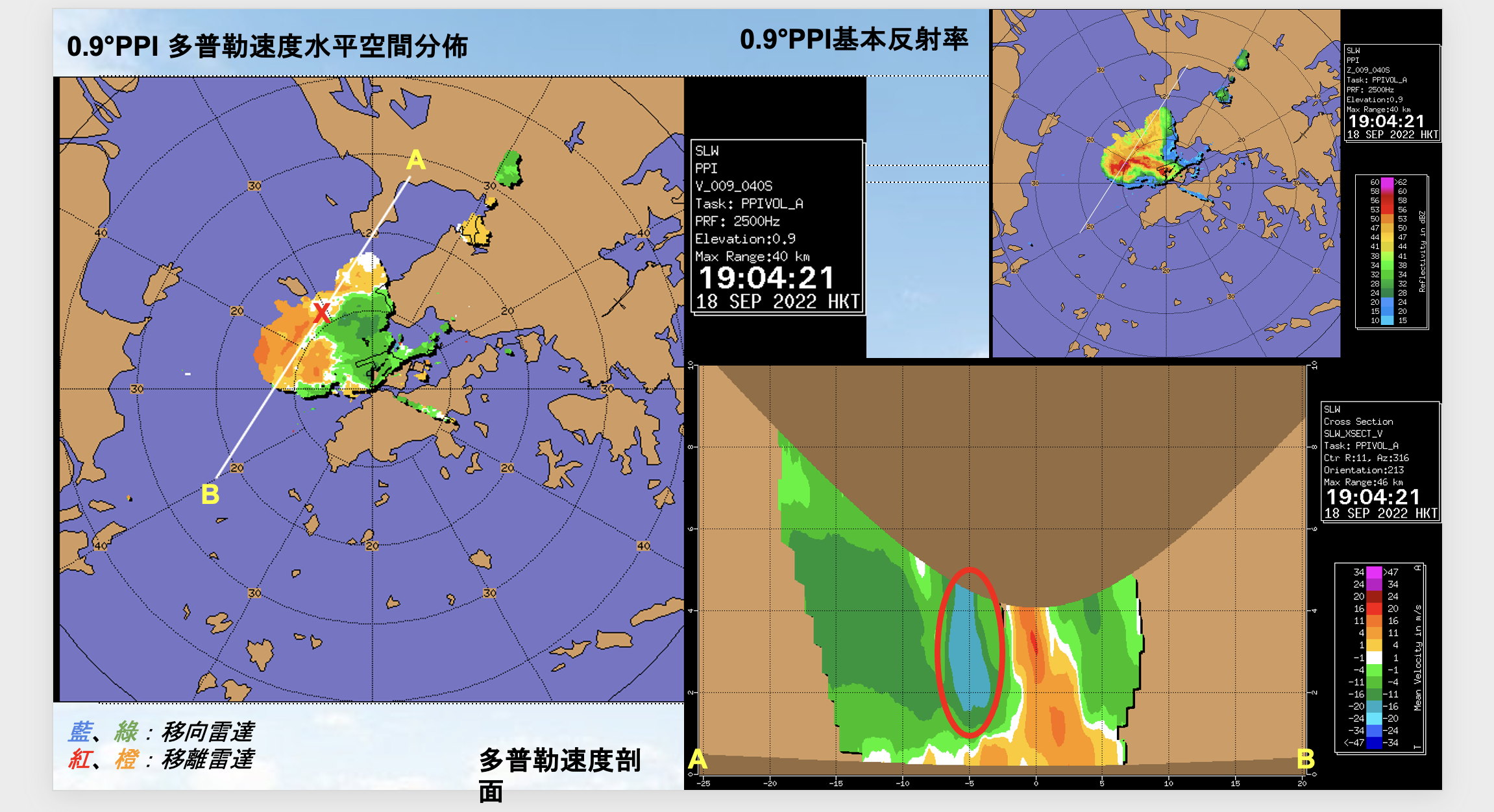
Doppler velocity, reflectivity and an A to B vertical cross-section through the Chek Lap Kok storm
Chek Lap Kok storm at 19:04:21 HKT on 18 September 2022. The 0.9° velocity field defines the A–B transect; the red ellipse in the cross-section highlights the narrow low-level velocity feature beside the storm, while the reflectivity inset shows the corresponding convective core.
Surface wind observations around Lantau and Chek Lap Kok one minute after the radar cross-section
Surface winds at 19:05 HKT, one minute after the radar panel. The observations show a sharp directional contrast between the waters north-west of Lantau and Chek Lap Kok airport, providing surface context for the radar-observed outflow.

04

Implications

The case studies demonstrate how rapid scanning, dual polarisation and fine spatial sampling can complement a conventional radar network. The strongest operational value is not a single new product, but a denser view of storm evolution that can support diagnosis of hazards developing on minute-scale timelines.

05

Limitations

This was an event-based, preliminary evaluation rather than a statistical verification study. X-band attenuation, terrain blockage, range limitations and differences between radar sites complicate direct comparison. More cases and operational verification would be needed to quantify forecast improvement.